

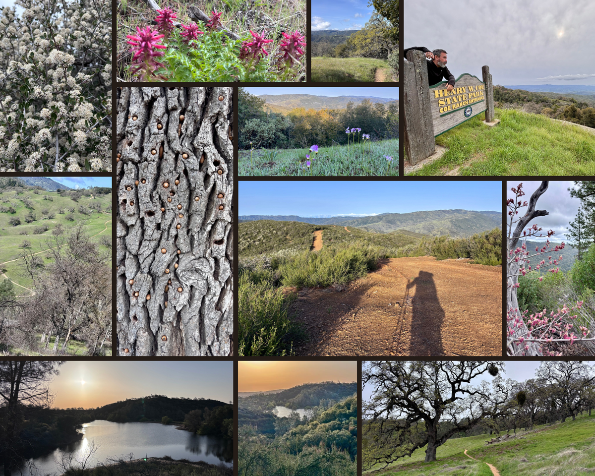
Backpacking Henry Coe State Park, DAY 2: Creeks And Climbs
After a tiring Day 1 backpacking at Henry Coe State Park, I was relieved to get a solid night of sleep. The frog choruses would ramp up and fade out every few hours, but it was oddly soothing listening to them.
Initially, I was worried that ditching my cushy REI AirRail sleeping pad in favor of the NEMO Switchback (a closed-cell foam pad often called an “accordion” pad for the way it folds up) would destroy my back, but I was pleasantly surprised! Somehow that thing defies the laws of physics, which I got a first taste of that time I spent the night in a Yosemite Valley bathroom.
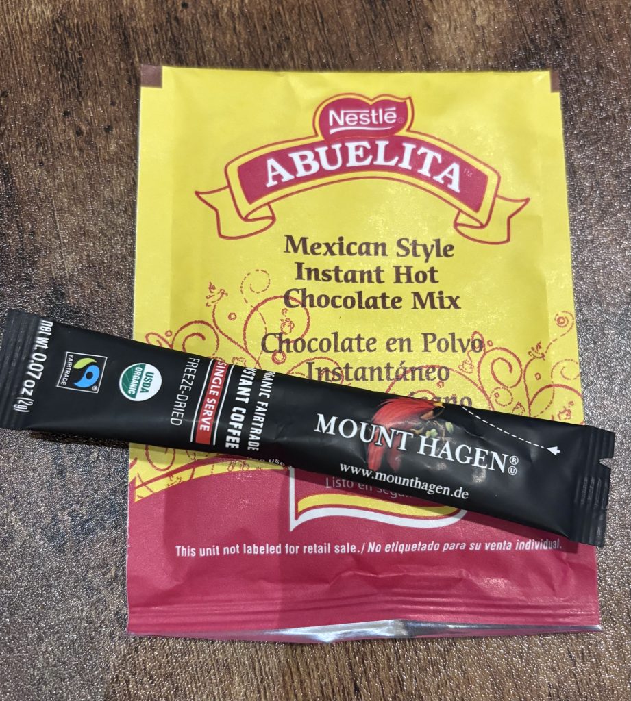
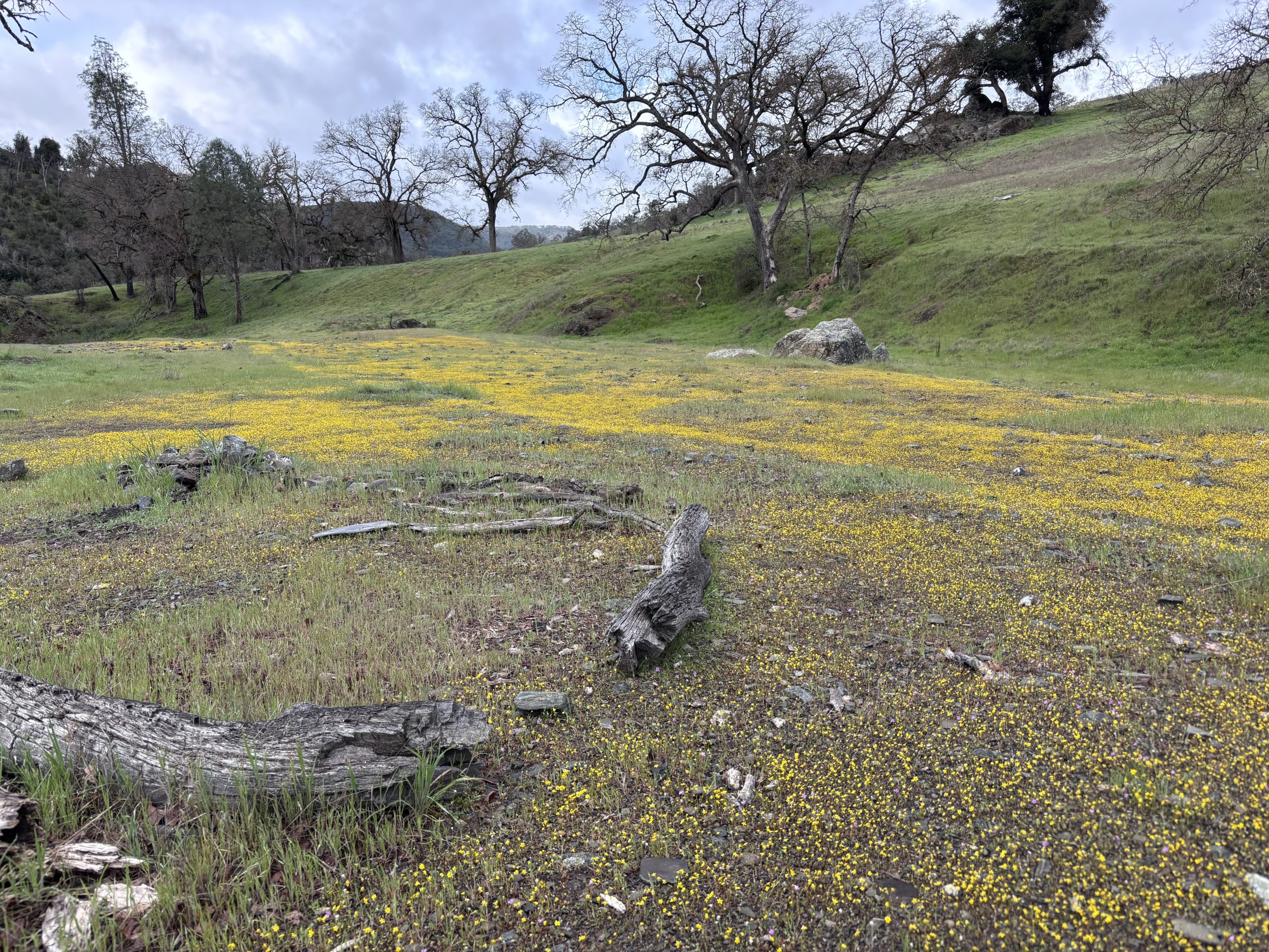
After greeting the dawn, I spread out my tent’s rainfly over a large rock (it had rained a bit overnight), and enjoyed my favorite Mexican Mocha concoction by the creek.
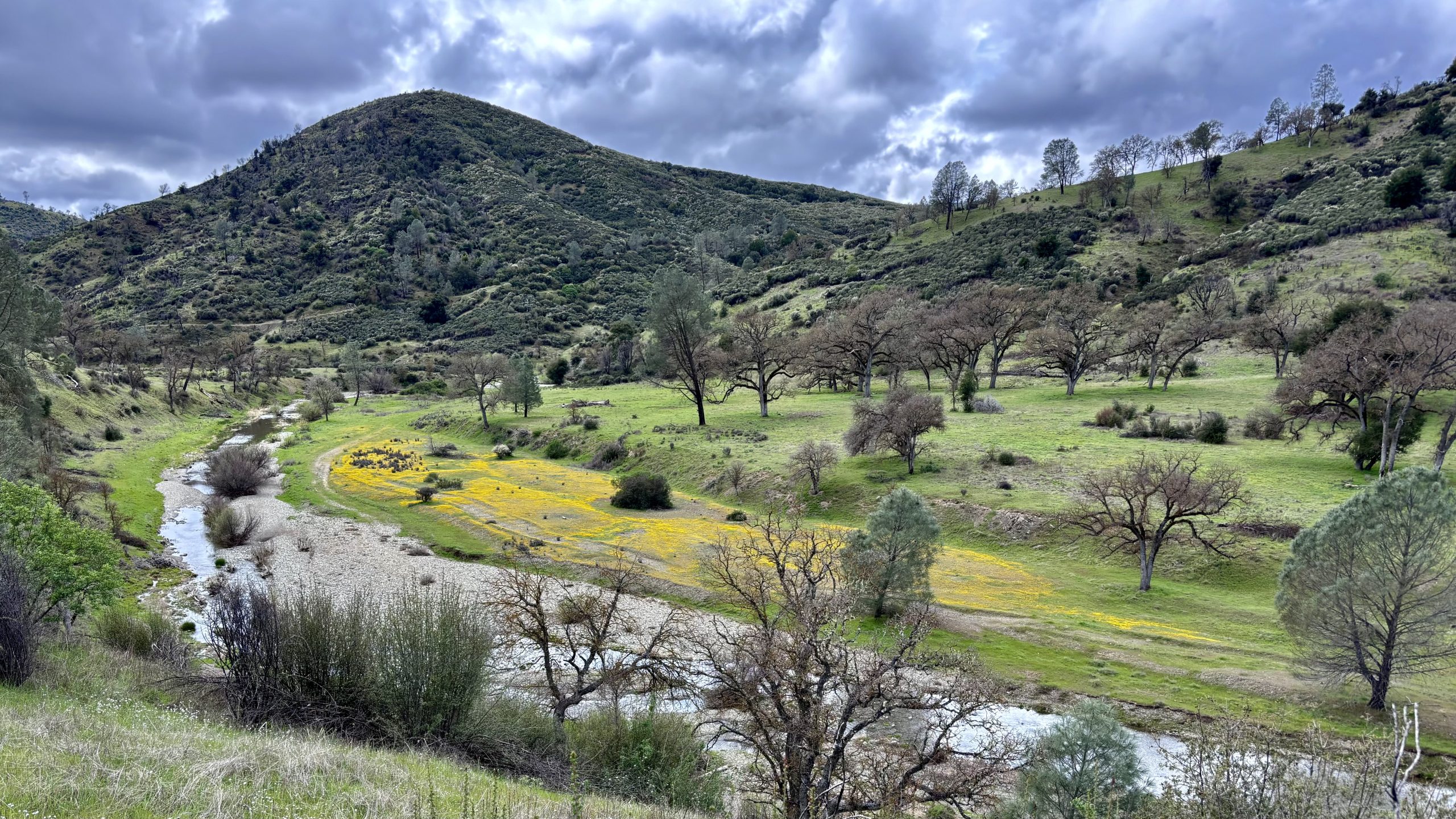
The bittersweet thing about camping in the backcountry like this is that I want nothing more than to sit by this peaceful creek and be surrounded by these rolling green hills and mountains all day. Just letting the time pass, while nature does its thing. But I had a schedule to keep.
That’s actually another lesson worth sharing. If you know you’re going to have the opportunity to camp in solitude next to moving water of any kind, treat yourself and stay an extra day. Relax, read, write, stroll around, soak it all in. If I do a similar adventure here again, I will absolutely slot in that rest day.
A relax day; because we all deserve that.
I procrastinated packing up camp and hitting the trail because I had a bit less mileage today, and I ignorantly thought it would be an easier hike. And frankly, I didn’t want to leave this place.
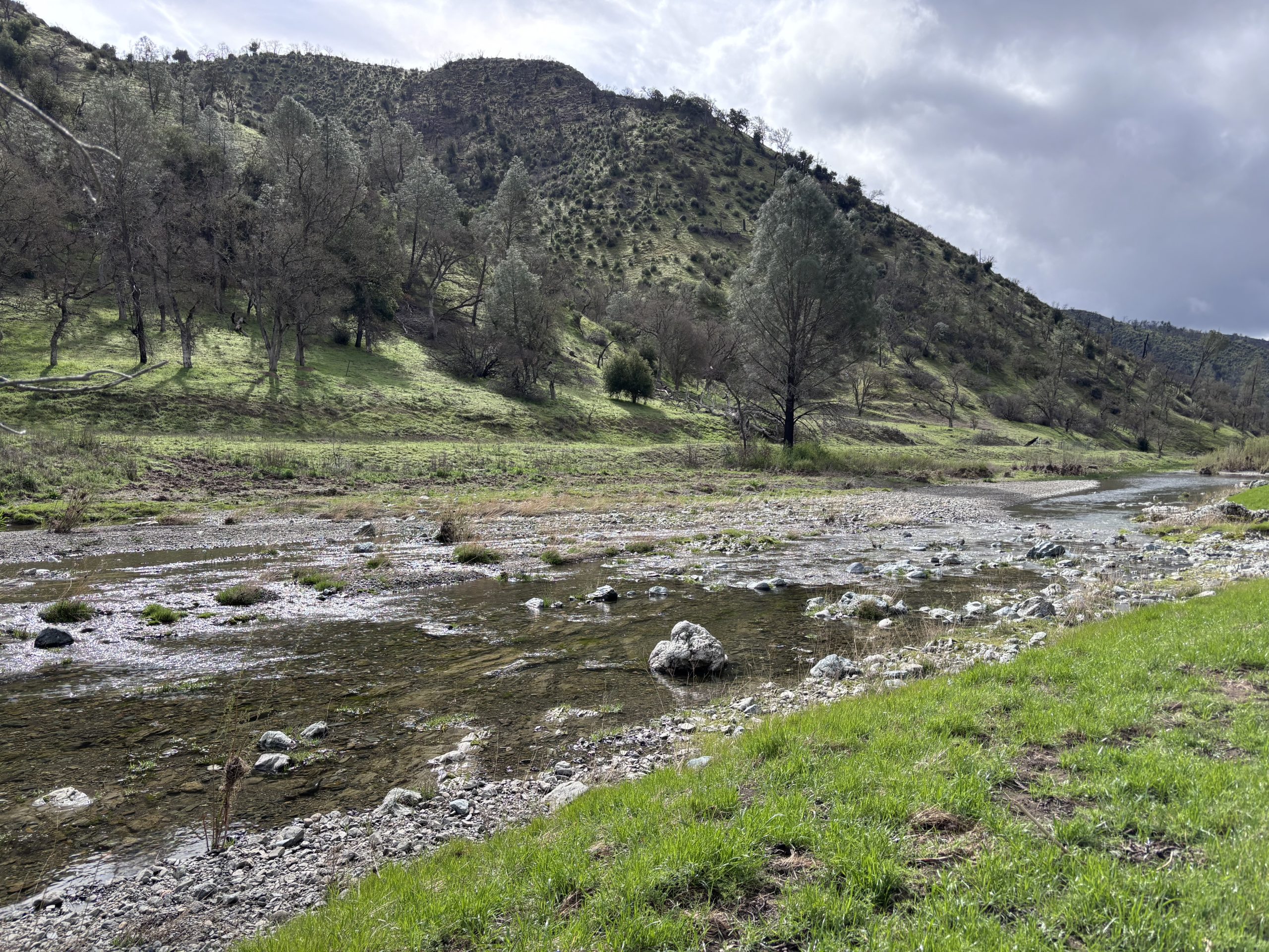
With the rainfly still wet, but my stomach full and my all my senses happy, I packed up camp and crossed the creek. I’d pick up the Narrows Trail and later Bear Mountain Road, then it was onward to Mississippi Lake.
Henry Coe State Park: “We Hope You Love Crossing Creeks!”
The first 3 miles were blissfully flat as the trail wound its way around – and repeatedly through – Coyote Creek. But those easy miles weren’t dry!
I probably splashed through the creek 7 or 8 times within 3 miles, and eventually I stopped swapping my trail runners with my Crocs. This might defy conventional logic. Why not just leave my water shoes on? I just have a difficult time walking through uneven terrain in any kind of sandal, and they don’t provide the kind of foot support to avoid a twisted ankle if I stepped wrong.
Plus, I was worried they’d give me blisters. Which is hilarious looking back, because sloshing up and down steep hills with waterlogged shoes certainly isn’t exactly going to prevent blisters!
Oh look, another lesson learned! Next time I’ll study my map more carefully. I’ll anticipate those water crossings and prepare for them.
I’m going to spare you the photos of my blistered feet at the end of the day. Suffice to say it was not a pretty sight, and it made day 3 downright grueling.
I’ll be honest with you, because this blog isn’t just a highlight reel with pretty pictures and happy tales: I struggled to keep a positive attitude today. Not because I was repeatedly splashing through the creek. Once I embraced that reality and decided to stop playing musical shoes, it was fun!
No, that reason was Bear Mountain Road.
Henry Coe State Park: “We Don’t Believe In Switchbacks!”
When I reached the junction, I looked at what appeared to be the steepest climb I’d ever seen. The grade was more extreme than anything I’d hiked at Yosemite, including Upper Yosemite Falls which I thought was the stairmaster workout from hell.
Not anymore. Now that hike looked like a cakewalk. A recurring theme for my hiking journey so far…
A lunch break by the creek sounded like a smart choice before trudging up that road. After eating a quick tuna wrap and a Cliff Bar, I topped up my water in the creek and started filtering it.
…And my Sawyer Squeeze bag sprung a leak. Fortunately, I had a second one with me, and I still had the capacity to carry 3 liters of water, so it wasn’t an emergency. But since they weigh next to nothing when empty, I’ll definitely bring a spare next time. Running out of water in the backcountry is a nightmare I’d rather avoid!
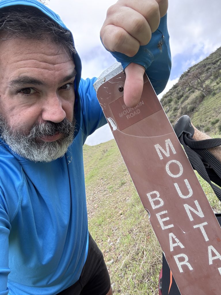
Bear Mountain Road was waiting, and daylight was burning. I queued up Green Day’s “Dookie” on my iPod, and started hiking. I bring up the album because I remember stopping to look down at the valley I’d come from during “She” (probably only 2/3 through the album) and being shocked how high I’d already traversed in such a short time.
Not because I was kicking ass, dear reader. Because it was absurdly steep. Not Class 3, where you need to climb with your hands. But it’s the kind of steep where you jab your poles into the ground and propel yourself forward, walking on your tiptoes because it’s just about too steep to even plant your feet flat.

Doing this with a 40 pound pack pushed me to my mental and physical limits. It somehow felt like a rollercoaster that never descended.
The climb to Bear Mountain felt endless. I really, really, really missed those nonstop switchbacks from Upper Yosemite Falls. And switchbacks of any kind. At least they make steep uphill treks more manageable.
But eventually it did start descending, through thorny patches of chaparral where the rarely-trafficked trail becomes almost invisible. For a couple miles, it was really more about pathfinding and heading in the right general direction.
About a mile before Mississippi Lake, I came to one of the water sources the ranger had circled. Bear Spring. He had not mentioned it may be difficult to source water from the lake itself, but I had a vague hunch that prompted me to grab a couple liters of water here, just in case.
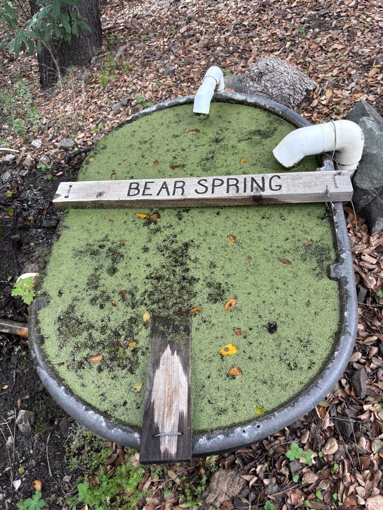
The Sawyer filter did its job, but this was not the best tasting water in the world! I’ve heard that PCT thru-hikers have experienced exponentially worse water sources, though. So I let gratitude win this round.
All told, today was tougher than yesterday despite less mileage. It taught me lessons, though. It also made me realize I need more conditioning, more practice, and honestly, more humility.

By the time I made it to Mississippi Lake, I was thrilled to discover I’d once again have camp all to myself. Hell, I had the entire lake to myself! But I was feeling broken and somewhat defeated despite sticking to my schedule and making it here in one piece.
I was too exhausted to truly enjoy my surroundings. And I would later realize that’s my biggest regret about this trip.
After setting up my tent and devouring some Mac & Cheese, I fell into my sleeping bag and was asleep before the sun went down.
NEXT:
Member discussion