

Hiking The Oregon Coast Trail, Day 5: High Tide & Sneaker Waves
Today I’m hiking from Indian Beach to just north of… wait, let me back up. It’s not all about the trail, after all. It’s also about the experiences bookending it.
Part 1: The Bliss Before The Storm
This morning has been incredible! Riveting conversation and great company with K. A beautiful drive with some sing-alongs courtesy of Alkaline Trio and Green Day. Utterly perfect oat milk latte and a breakfast sandwich from Manzanita Coffee Company. Just an amazing beginning to this day.
Recharged with a relaxing, restful day behind me, my spirits are high and I feel ready to attack this trail. There’s a cool breeze, it’s about 50 degrees out here, and I feel fantastic!
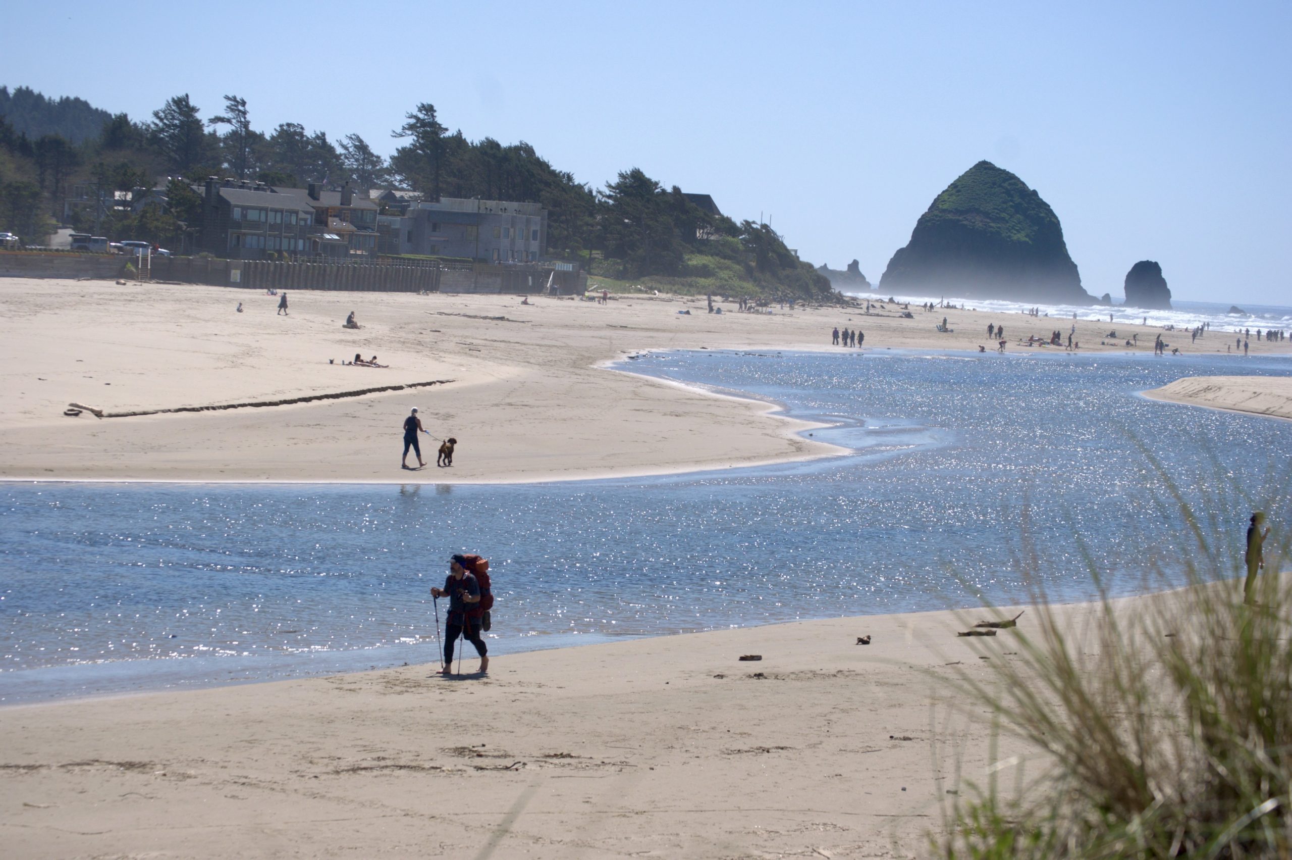
Today, I should clock around 11 miles. I’m hiking from Indian Beach (the location where scenes from The Goonies and Point Break were filmed!) to just north of the Arcadia Beach State Recreation Site. In between I’ll walk across Cannon Beach and the iconic Haystock Rock — another real-world location from The Goonies!
Camp tonight will be between Silver Point and Hug Point, a small stretch where beach camping is legal — something I’ve never experienced! I’m already daydreaming about ending my day with a hot chocolate and a small fire while I watch the sun dip into the Pacific Ocean.
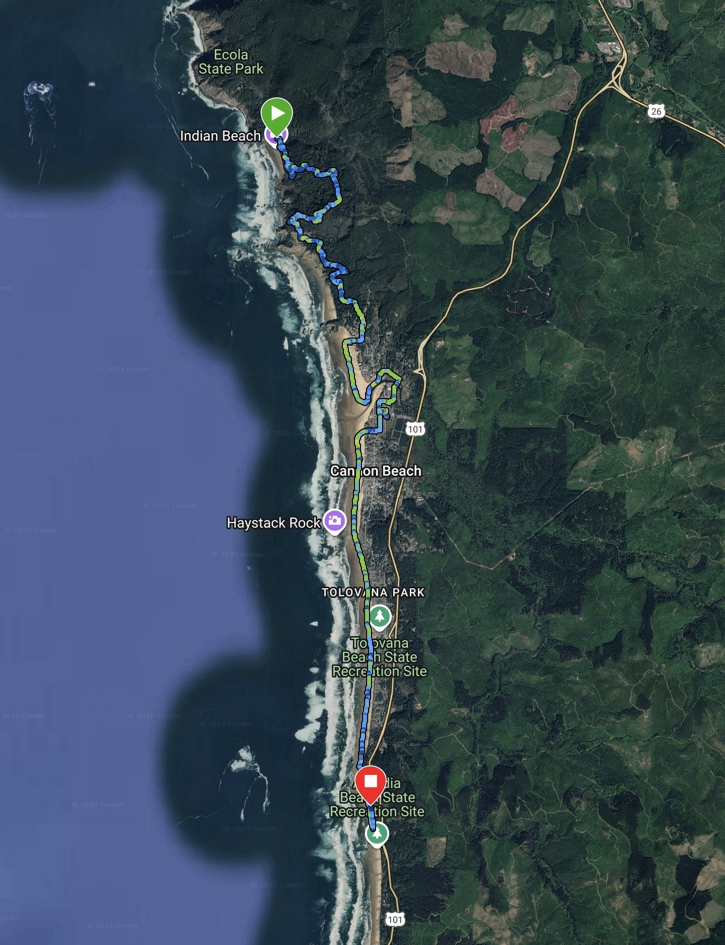
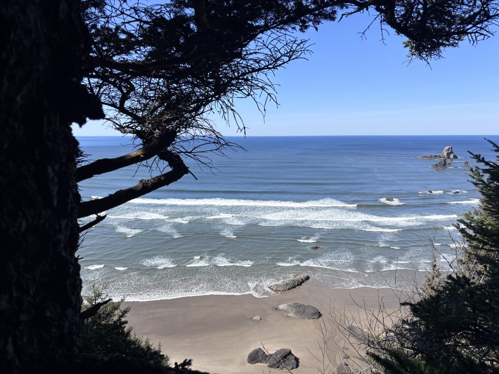
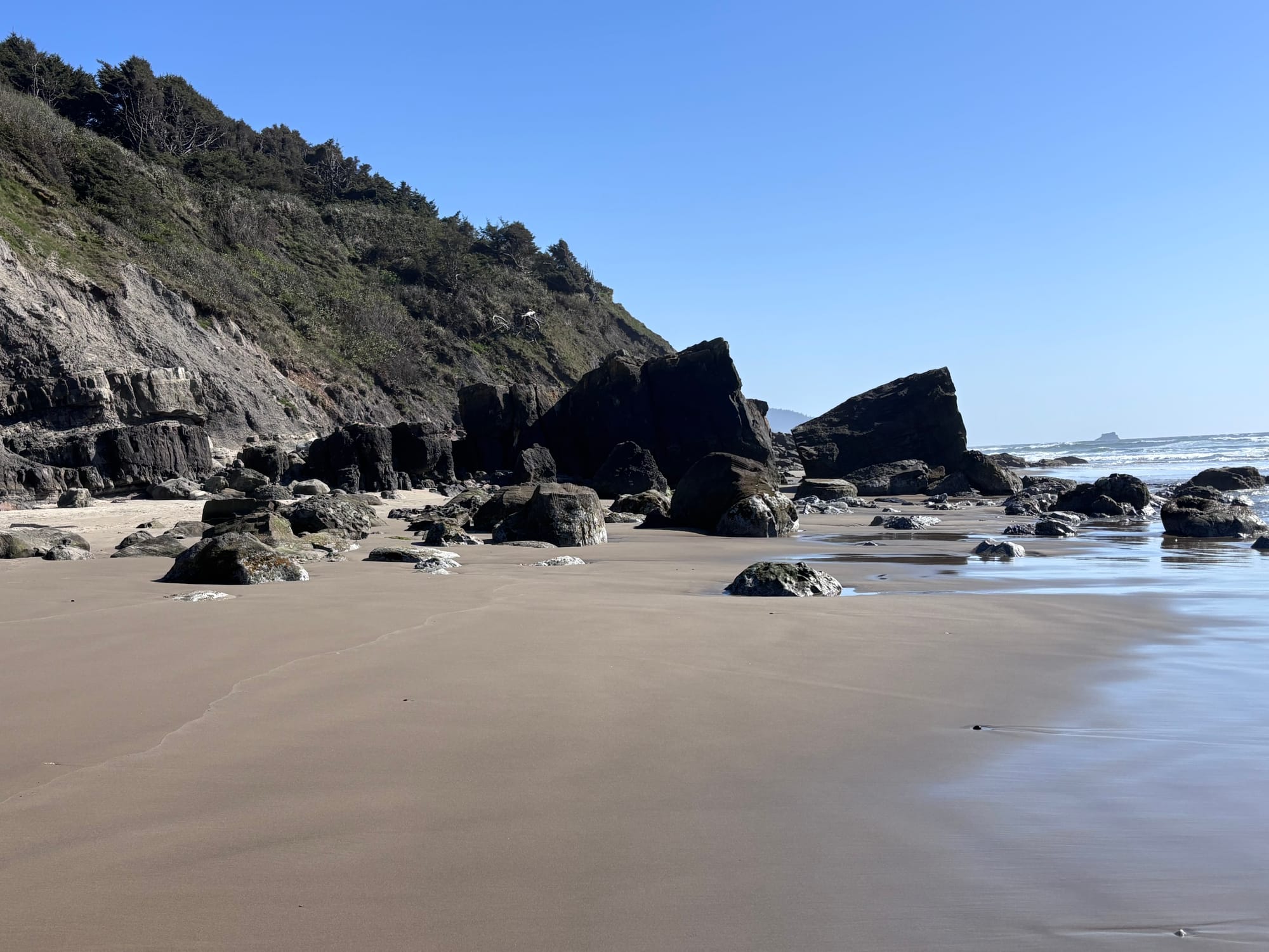
The trail alternates between muddy, steep, and stunning; frequently all three. Not even one mile in, the path leads to an overlook where a group of teens are talking quietly and clearly admiring the view, looking down onto the water where the waves gently lap against jagged rocks jutting out of the ocean, and the smooth sand on the shore.
It’s so achingly beautiful and peaceful and mesmerizing walking among these trees, frequently getting peeks of the shoreline below the cliffs. I get so distracted by the scenery I miss a detour that was marked on the FarOut guide. A detour which was clearly designed to take me around this massive impassible landslide I’m now staring at!
I backtrack a bit, mildly angry at myself, but studying the route for the next several miles so I don’t repeat the same mistake.
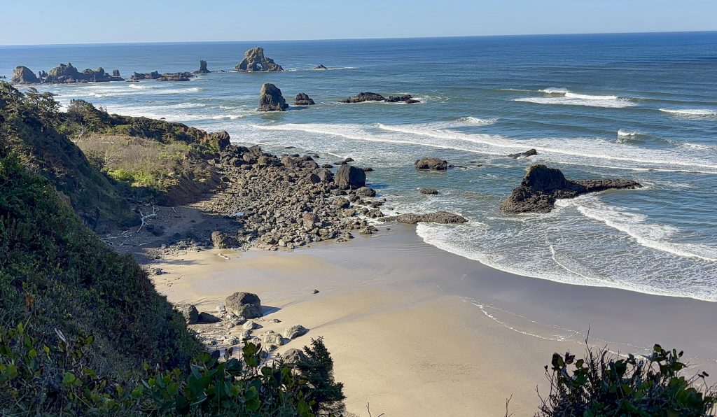
The Indian Beach trail eventually dumps me out into a large grassy clearing with a parking lot, bathrooms, and paved paths. But I need to connect to the Crescent Beach trail, which throws a mildly intimidating warning at hikers:
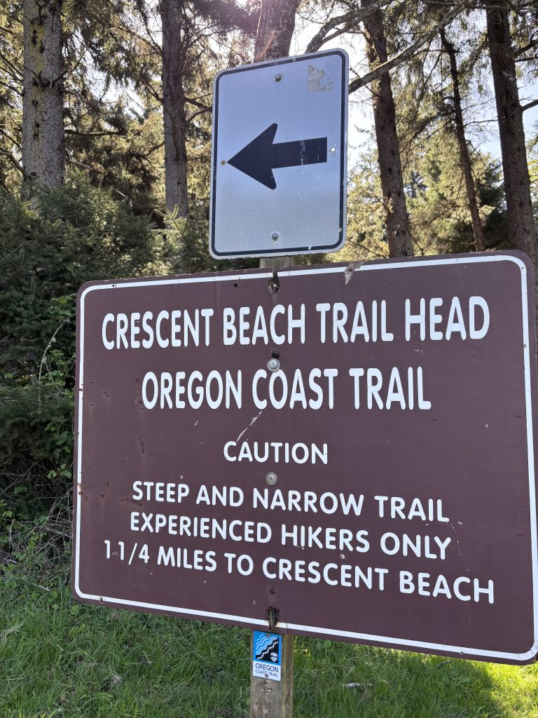
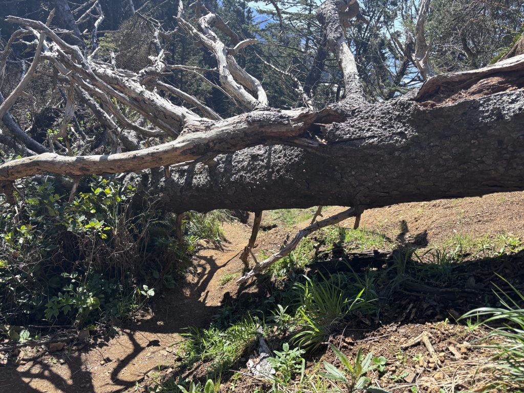
Aside from two sets of steep wooden stairs and a couple sections that are indeed narrow, it’s an enjoyable stretch with no technical challenges to navigate aside from some mud crossings and maybe navigating over or around a downed tree. I see a few sets of families with kids hiking northbound from Crescent Beach.
I don’t think the “Experienced Hikers Only” suggestion is warranted, but I suspect that accidents in the past have prompted the sign. Just be careful, be aware, and go at your own pace and you won’t have any problems with this jaunt down to Crescent Beach from the trailhead.


Before the junction heading down to Cannon Beach, I open my Notes app to jot down more thoughts, which I must be doing at least 20 times per day to capture the onslaught of observations racing through my head, and the constantly changing beauty surrounding me.
I already have 6 videos, 5 voice notes, and dozens of photos in today’s entry. It starts to feel like I’m writing a book, and I chuckle at the belief that not even a full-color book riddled with professional photos and meticulous descriptions could do this trail justice.
And I haven’t even hiked the first 40 miles of the OCT yet!
Hiking down Cannon Beach and along Ecola Creek | Photos courtesy of CapturedByKimber
As I walk across Chapman Beach, K and I arrange to meet in Cannon Beach for some ice cream at Suzy’s Scoops. I’ve been fantasizing about Tillamook’s Marionberry Pie for days. It’s been years since I last ate it, and it’s a rarity to find it in stock in California grocery stores.
The woman at the counter crushes my dreams and blocks my sweet tooth by apologizing that they’re out of Marionberry Pie ice cream. Then she pauses and offers to double-check in the back. JACKPOT!


If the kind woman who served me at Suzy’s Scoops ever reads this, I have to reiterate how grateful I am that you took the time to search for that container of Tillamook Pie!
K sips on a cold brew coffee float and I savor my ice cream. With each bite and each passing minute sitting down, it gets harder to summon up the energy to throw my pack back on and continue hiking, but the second my feet hit the sand it’s as if my batteries are instantly recharged.
Cannon Beach is lively, and this is a magnificent stretch! Two ornate sandcastles near the high tide line are begging for a closer look. There’s a ladybug walking along the sand. People are lounging, flying kites, throwing frisbees, laughing.


Some are giving me curious long looks. I imagine they’re wondering what my story is. Where am I going? Where did I come from? How long have I been walking and why?
I laugh at a large white dog (possibly a Pitbull) joyously bounding across the sand, looking for someone to play with. The dog bursts into a full sprint, wagging its tail, seeming to relish every second of being alive.
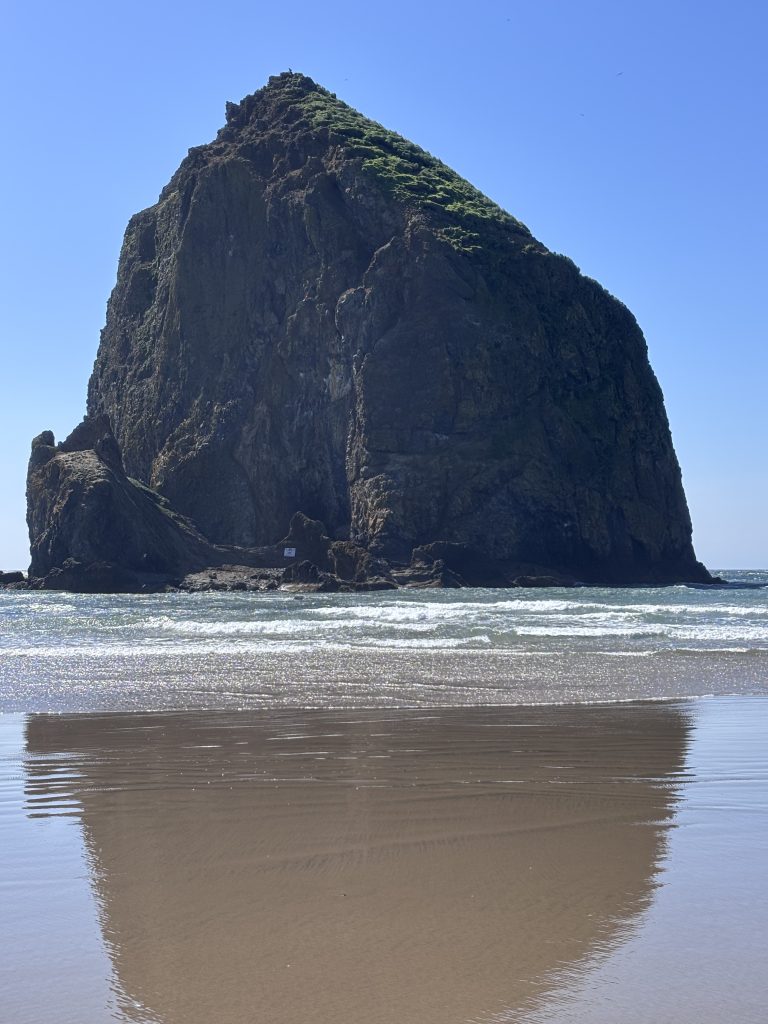
K meets me briefly at Haystack Rock, not just because she’s a huge fan of The Goonies, but for the possibility of spotting some Tufted Puffins perched high on the majestic rock. I think I see one, but without binoculars it’s tough to be certain.
Note to self: add binoculars to the next long hike. It’s worth the weight!
Part 2: High Tide Panic
Time passes smoothly, with endless beach and pounding surf at the forefront of my senses.
As I approach Silver Point, I’ll be navigating my first major tide alert on the OCT.
A tide alert, at least where the Oregon Coast Trail is concerned, indicates a specific area where you need to round a small headland that protrudes into the water. Typically, you can only walk around these at low tide. Otherwise, you’re either climbing rock or backtracking and taking a neighborhood or highway detour.
What’s tricky about my next few miles is the tide alert after this, Hug Point, can only be rounded within about an hour of low tide. So, my plan is to camp on the beach — in a small stretch where it’s legal — and round Hug Point first thing in the morning at low tide.
Once I commit, I’m essentially “stuck” between these two points after the tide starts rolling in.
Nervousness tugs at my consciousness as I start rounding Silver Point. The slightest, weakest, barely-there perception that maybe I’m making the wrong decision.
I don’t see any warnings about camping on this stretch of beach.

I reassure myself that it’s an absolutely massive, wide beach and the predicted 6.1ft high tide can’t possibly swallow this entire beach. I find a dry, sandy spot nestled right up against the bluff, and I start to feel more confident that I’ll be safe.
To further assuage my concern, I start asking locals walking by if they’ve ever seen the tide reach where my tent is pitched. They all say no.
Still, anxiety is lurking in the fringes. High tide is at 1:26am. Before scrounging up firewood, before prepping dinner, I set an alarm for 12:30am. I’ll have a peek an hour before high tide just to make sure I’m safe.
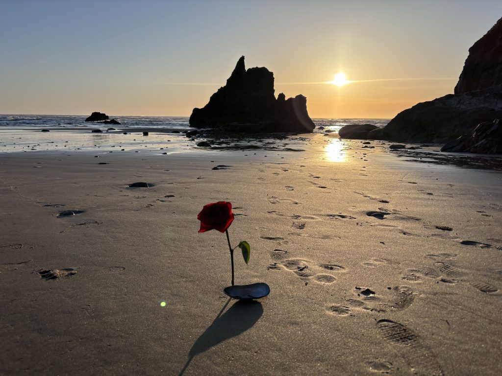
The next few hours are pure bliss. As I’m gathering driftwood for a fire, I see a rose with its stem stuck in the wet sand closer to the water. This is the second rose sighting in four days of hiking, and yet again I wonder what story it might tell me. I hope it’s a happy one.
About an hour before sunset, I scarf down a quick dinner of lentil and veggie stew, start a cozy fire, and sip on some Mexican hot chocolate. It’s the perfect evening. I mean come on! I have the beach to myself, a fantastic sunset to soak in, and a fire to warm my bones. It’s serene. It’s heaven on a beach.
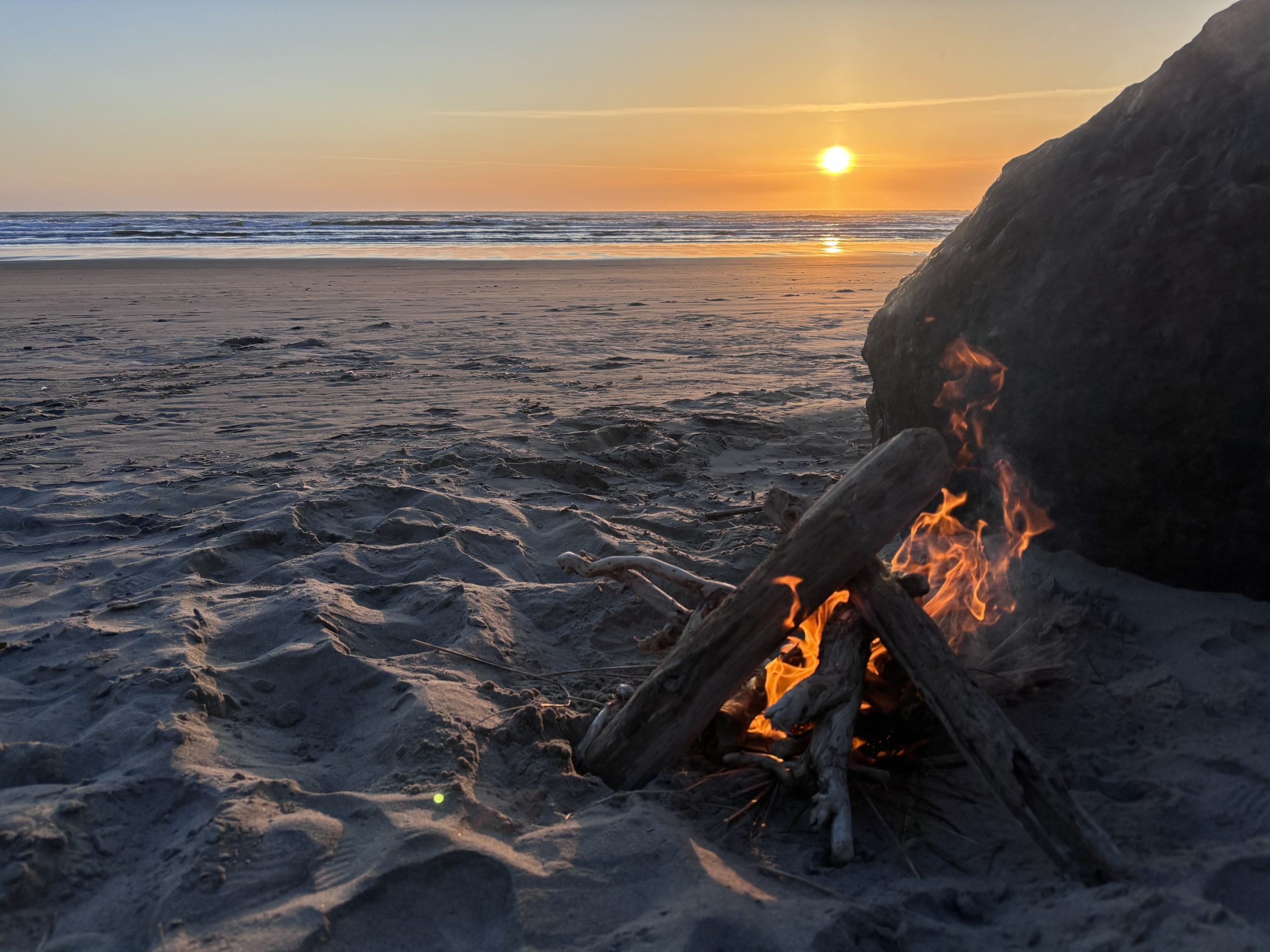
After the calmest, most beautiful hour in recent memory, I put out the fire and drift off to sleep.
At 12:30am my alarm wakes me. I unzip my tent door, get to my feet, and stare in disbelief at a wave that’s only 15 or 20 feet away from me. The tide has marched up the beach significantly in the last few hours. Before going to bed, I had thought about rinsing my mug in the water but couldn’t be bothered to walk out that far!
Now here it was, practically in spitting distance.
I do not feel safe. And I am not calm.

I try not to panic. I try to keep a level head. I hurriedly throw everything into my backpack, and toss it up on the bluff. Hopefully it will stay dry if the worst happens.
I leave my tent in place for now, securing it with some heavy rocks around the edges of the inner wall. Maybe if the waves only lap at it, it won’t get swept away?
At 1am, the panic ramps up as the tide continues rolling in, now only about 8 feet away from my camping spot. I’m pacing back and forth, unsure what to do except ride it out.

My only escape route is up the bluff. I believe I can climb it if the situation demands it, but not with my pack on my back…
Out of nowhere, a wave crashes in way past the foam line and rolls a few inches underneath my tent. The panic consumes me as all the worst case scenarios assault my imagination.
I still haven’t pulled up my tent. If I have to climb a cliff to safety, there’s no way I could accomplish that with all my gear strapped to my back, so what’s the point in trying to salvage it?
So I pace, and I record voice notes to hear something besides the ocean, and I wonder if this is the abrupt end to my Oregon Coast Trail adventure.
At 1:28am, peak high tide continuously sends waves under my tent, but never threatens to unearth it and sweep it away. I sit perched on a rock until I can visibly see the tide receding, but even then I don’t feel safe.
At 2:30 I finally feel comfortable throwing my sleeping bag back in the tent and laying down. But there won’t be any more sleep tonight. My nerves are shot. I’m pissed off at myself. And every time I hear a wave crash, a small jolt of fear courses through me.
Part 3: Never Turn Your Back On The Ocean
Tonight, Mother Nature gave me a gentle lesson. You don’t get many of those, and I feel fortunate. I’m not taking that lesson for granted either, so I need to break the narrative here and help prevent anyone else from making a mistake that could cost them their life.
While California and Oregon share the same Pacific Ocean, it does not behave the same. To begin with, a phenomenon known as “sneaker waves” are prevalent in the Northwest. These are dangerous waves that can surge much further up the beach than you’d expect, sometimes reaching 150 feet beyond the foam line. That’s about the combined length of two full-size tennis courts.
I’ve walked on California beaches that are barely that wide to begin with.
A single sneaker wave is also powerful enough to lift entire logs off the ground and hurl them at you. Essentially, this makes even casually strolling down an Oregon beach potentially dangerous if you’re not aware.
The tides here also behave more aggressively, and can easily swallow up an entire beach. It’s astounding how far they can stretch, especially if you’re used to Central or Southern California beaches.
Never turn your back to the ocean anywhere, but especially in the Pacific Northwest. And remember that just because you can legally camp on the beach, doesn’t mean you should.
On day 5 of the Oregon Coast Trail, Mother Nature taught me to respect the ocean, without exception. I urge you to do the same.
Member discussion